World Map Black and White: How to Choose and Use One
A world map black and white doesn’t just show you where countries are. It gives you a bold graphic element that works in homes, offices, classrooms, and design projects. A black and white world map prints cleanly, scales without losing quality in vector formats, and works as a backdrop for data visualization and educational displays. A map of world black and white also avoids the dated look that color-coded political maps develop as borders change.
Whether you’re looking for a world map in black and white for your living room wall or an earth map black and white for a presentation, the considerations are the same: projection type, detail level, and intended use.
Map Projections and What They Mean for Your Use
Mercator vs. Equal-Area Projections
The most common world map black and white format uses the Mercator projection, which stretches landmasses at the poles. Greenland appears roughly the same size as Africa in Mercator, though Africa is actually 14 times larger. This distortion is well-documented but often overlooked when choosing a decorative map.
If accuracy matters to your use case, a black and white world map using the Robinson or Winkel Tripel projection represents landmass sizes more accurately. These projections appear in most contemporary educational materials. An earth map black and white in Robinson projection works better for classrooms and data-driven presentations than Mercator.
Political vs. Physical Map of World Black and White
A political map of world black and white shows national borders, country names, and capital cities. A physical version shows terrain: mountain ranges, deserts, rivers, and ocean depth gradients. Physical world maps in black and white use shading rather than color to show elevation, which can look striking as large-format wall art.
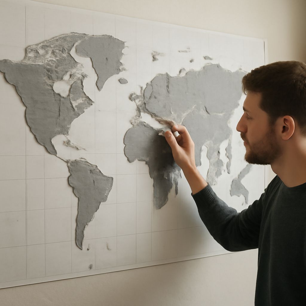
Using a World Map in Black and White for Decor
A world map in black and white at 24×36 inches or larger makes strong wall art in living rooms, home offices, and hallways. Print on a matte fine-art paper (300gsm or heavier) to avoid glare and give the image a gallery-quality feel. Frame with a simple black or natural wood frame and a 2-inch white mat.
A black and white world map as a canvas wrap eliminates the framing cost and ships ready to hang. Canvas prints work well in casual spaces. Paper prints with frames look more formal and are easier to replace if you want to swap artwork later.
Digital Uses for an Earth Map Black and White
An earth map black and white in SVG format scales to any size without pixelation, which makes it ideal for presentations, reports, and web design. Natural Earth Data and the UN Cartographic Section both provide free vector world maps in black and white formats licensed for non-commercial use.
For commercial design work, stock libraries like Adobe Stock and Shutterstock carry world map black and white vectors with commercial licensing included in standard subscriptions. A clean vector map of world black and white at 300 DPI exports cleanly to any print size, from a business card to a trade show banner, without additional cost per use after the initial license fee.